A History of Maps!
The earliest map we have is the Babylonian Imago Mundi from 600 BCE. The clay tablet shows Babylon at the heart of a seven-pointed star of islands. The accompanying text describes three of the islands:
1-"place of the rising sun"
2-"the sun is hidden and nothing can be seen"
3-"beyond the flight of birds"
 |
| Babylonian Imago Mundi |
The idea of the nation drawing the map being at the center of the world would continue throughout the ages. Human nature creates a false sense of center. We all think we are the center of the world. It has led to flat world theories, the earth being the center of the universe, and numerous wars.
Similarly Anaximander created an Aegean-centered world map c. 610 BCE. This map would form the basis of most cartography for the next 700 years. Each generation slightly improving upon the original.
The incremental changes built up until we get to Ptolemy's map c. 150. This new map revolutionized the concepts of cartography. Ptolemy introduced longitude and latitude as well as aligning terrestrial and celestial observations. His ideas and descriptions would influence map makers for over 1000 years.
 |
| 15th century reconstruction of Ptolemy's World Map |
Ptolemy did not draw a map that exists to modern times. In the 1300s his manuscript for Geographia was rediscovered and promptly people started drawing maps based on his descriptions. The map is flawed but set people in the right direction. Within 100 years we would have maps that begin to look like the world as it truly is.
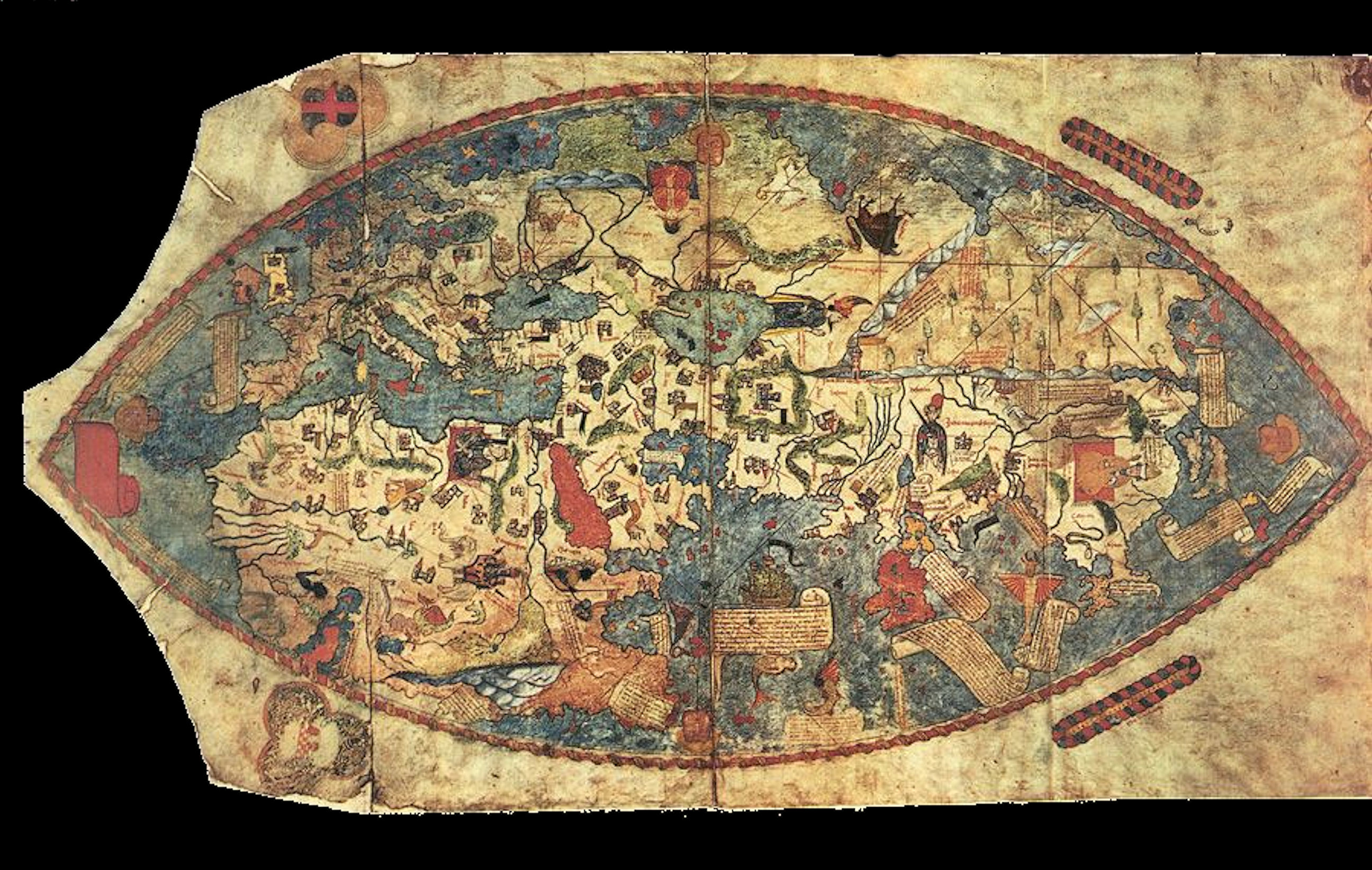 |
| Genoese map of 1457 |
While the Genoese map is somewhat confusing to look at, Europe, northern Africa, and Asia are all clear and mostly the right shapes.
What I would consider an early true 'modern' looking map of the whole world is the Theatrum Orbis Terrarum (1570) by Abraham Ortelius. 60 years later the Nova totius Terrarum Orbis (1630) by Hendrik Hondius. This map is basically the world as it is.
And it only took 2200 years!
_balanced.jpg) |
| Nova totius Terrarum Orbis (1630) |
No comments:
Post a Comment